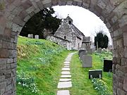
Gaer (Black Mountains)
Hill in the Black Mountains of WalesGaer is the name of a hill in the Black Mountains of the Brecon Beacons National Park in Monmouthshire, south Wales. It lies at the southern end of the long ridge between the valley of the Grwyne Fawr and the Vale of Ewyas, one mile north of Bryn Arw and three miles northeast of Sugarloaf. Its summit, at 427m above sea level, sits within an Iron Age hillfort known as Twyn y Gaer.
Read article
Top Questions
AI generatedMore questions
Nearby Places

Cwmyoy
Rural parish in Monmouthshire, Wales

Partrishow
Hamlet in Powys, Wales
Coed-y-Cerrig National Nature Reserve
Protected area in Wales

St Martin's Church, Cwmyoy
Church in Monmouthshire, Wales

Llwyn-celyn Farmhouse
Farmhouse in Llanvihangel Crucorney, Monmouthshire

Tabernacle Baptist Chapel, Cwmyoy
Church in Monmouthshire, Wales

St Issui's Church, Partrishow
Church in Powys, Wales

Ty-mawr Farmhouse, Cwmyoy
House in Cwmyoy, Monmouthshire
